
From m.a.d.e.
Ohh Deer Print Risograph Neon Bird
$17.49
Sorry, this product is out of stock from Truce but we’ve found some alternatives for you.
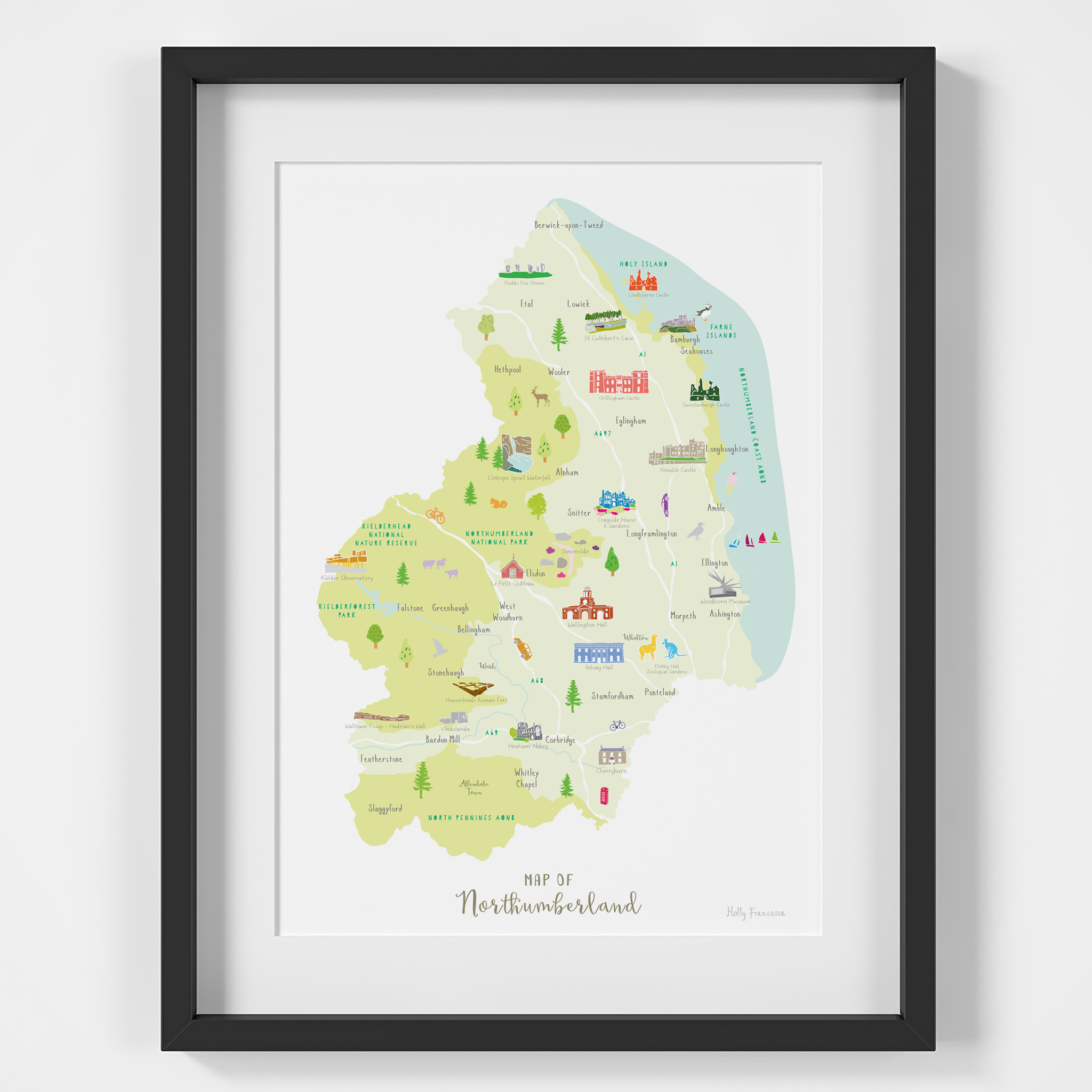
Illustrated art print map of the beautiful county of Northumberland in North East England. Created from an original drawing by Holly Francesca.
Locations include:
Berwick-upon-Tweed, Holy Island, Farne Islands, Etal, Lowick, Bamburgh, Heathpool, Seahouse, Alnwick, Northumberland Coast AONB, Northumberland National Park, Wooler, Eglingham, Alnham, Longhoughton, Amble, Ellington, Ashington, Whalton, Corbridge, Ponteland, Stamfordham, North Pennines AONB.
Points of interest include:
Duddo Five Stones, Lindisfarne Castle, St Cuthbert's Cave, Chillingham Castle, Dunstanburgh Castle, Alnwick Castle, Linhope Spout Waterfall, Cragside, Woodhorn Museum, Kirkley Hall Zoological Gardens, Hexham Abbey, Cherryburn, Walltown Crags, Vindolanda, Housesteads Roman Fort, Belsay Hall, Wallington Hall, Kielder Observatory, Le Petit Chateau, Simonside.
MATERIALS: Printed in the UK using high quality pigment inks on matt white paper. Please note that this print is sold unframed.
Cure your wanderlust with a framed print by artist Holly Francesca. Based in West Yorkshire, the brand creates hand drawn illustrated maps of UK counties spanning The Cotswolds to Cornwall to Angus. Like a visitors map but for your home decor, the prints are collectible and make great gifts.


