

From m.a.d.e.
Ohh Deer Print Risograph Neon Bird
$17.49
Sorry, this product is out of stock from Truce but we’ve found some alternatives for you.
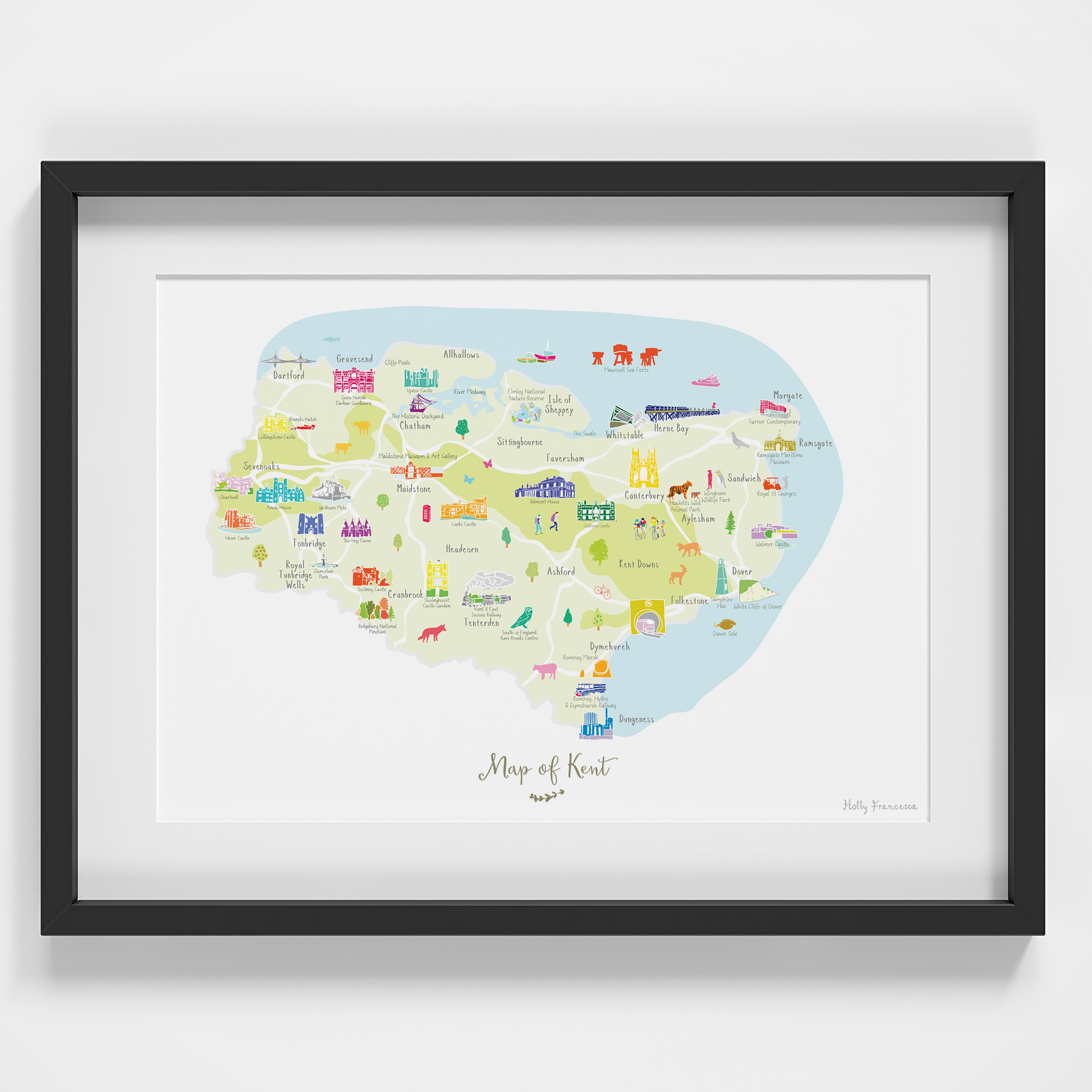
Illustrated art print map of the beautiful county of Kent. Created from an original drawing by Holly Francesca.
Locations featured: Sevenoaks, Tonbridge, Royal Tunbridge Wells, Whitstable, Chatham, Dover, Sandwich, Tenderton, Folkestone, Dunganess, Dartford, Kent Downs, Gillingham, Cranbrook, Headcorn, Dymchurch, Ashford, Aylesham, Canterbury, Faversham, Herne Bay, Margate, Ramsgate, Isle of Sheppey, Sittingbourne, Maidstone, Gravesend, Allhallows.
Points of interest include: Maunsell Sea Forts, Elmley National Nature Reserve, The Swale, Canterbury Cathedral, Howletts Wild Animal Park, Wingham Wildlife Park, Royal St George's, Walmer Castle, Ramsgate Maritime Museum, White Cliffs of Dover, Samphire Hoe, Chilham Castle, Belmont House, South of England Rare Breeds Centre, Kent & East Sussex Railway, Sissinghurst, Bedgebury National Pinetum, Scotney Castle, Dunorlan Park, Hever Castle, Chartwell, Knole House, Ightham Mote, The Hop Farm, Lullingstone Castle, Brands Hatch, Guru Nanak Darbar Gurdwara, Dartford Crossing, Upnor Castle, The Historic Dockyard, Maidstone Museum, Leeds Castle, Dunganess Power Station, Romney Marsh, Romney Hythe Dymchurch Railway, Turner Contemporary Gallery.
MATERIALS: Printed in the UK using high quality pigment inks on matt white paper. Please note that this print is sold unframed.
Cure your wanderlust with a framed print by artist Holly Francesca. Based in West Yorkshire, the brand creates hand drawn illustrated maps of UK counties spanning The Cotswolds to Cornwall to Angus. Like a visitors map but for your home decor, the prints are collectible and make great gifts.


