
From Curiouser & Curiouser
Ohh Deer 60's Flowers Risograph Art Print
$13.99
Star Curator
Sorry, this product is out of stock from Truce but we’ve found some alternatives for you.
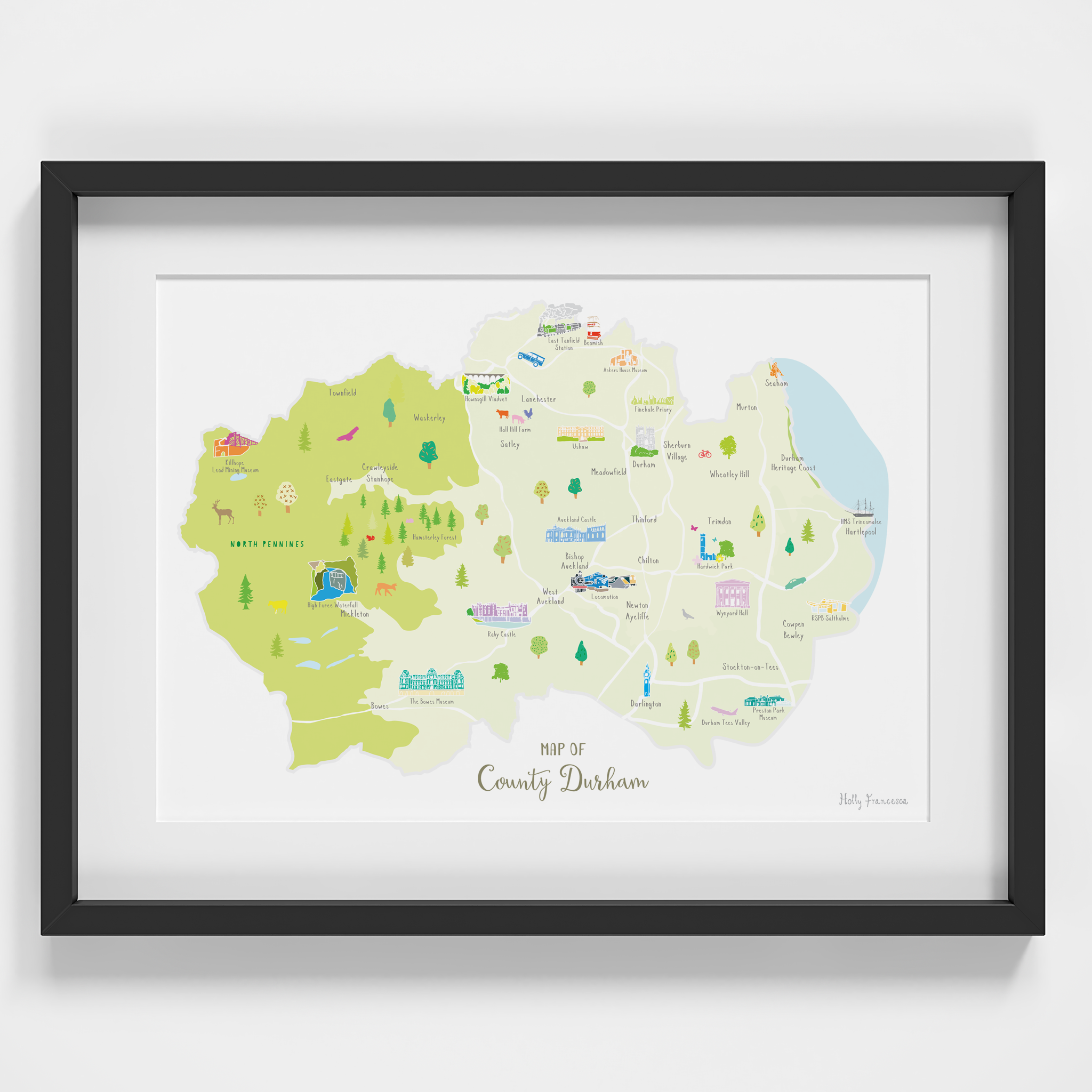
Illustrated art print map of the beautiful county of Durham. Created from an original drawing by Holly Francesca.
Locations featured:
Durham, Hartlepool, North Pennines, Darlington, Stockton-on-Tees, Townfield, Waskesley, Satley, Eastgate, Crawleyside Stanhope, Mickleton, Bowes, Cowpen Bewley, West Auckland, Newton Aycliffe, Chilton, Thinford, Trimdon, Meadowfield, Wheatley Hill, Sherburn Village, Durham Heritage Coast, Murton, Seaham, Lanchester.
Points of interest include:
HMS Trincomalee, RPSB Saltholme, Durham Cathedral, Preston Park Museum, Durham Tees Valley Airport, Locomotion, Wynyard Hall, Hardwick Park, Auckland Castle, Raby Castle, The Bowes Museum, High Force Waterfall, Hamsterley Forest, Killhope Lead Mining Museum, Howngill Viaduct, Hall Hill Farm, Ushaw, East Tansfield Station, Beamish, Ankers House Museum, Finchale Priory.
MATERIALS: Printed in the UK using high quality pigment inks on matt white paper. Please note that this print is sold unframed.
Cure your wanderlust with a framed print by artist Holly Francesca. Based in West Yorkshire, the brand creates hand drawn illustrated maps of UK counties spanning The Cotswolds to Cornwall to Angus. Like a visitors map but for your home decor, the prints are collectible and make great gifts.


